The eruption of Mount Merapi, 5 November 2010 had resulted many casualties which were generally caused by heat clouds "wedhus gembel." People's houses could no longer serve as a protector and mostly destroyed by the blast of hot clouds that supposedly reach speeds of up to 300km/hr. In addition to its high speed, hot clouds can reach temperature around 600 degrees Celsius. The threat was also come from hot material heap too often among the houses located near the peak of Merapi.
Till now, the only way considered as the most appropriate to survive the wrath of the hot cloud is of course to avoid it. No any single organism that can survive at that very high temperature even for short periods. In the 2006 eruption, even custom-made bunkers for protection against hazards for Merapi still killed two volunteers who were trapped in it. So in theory, the protection of buildings against heat clouds and avalanches of material is difficult.
However, it does not mean that nothing can be done related to the protection around this volcano hazards. To run away is the first choice that must be done, but for those who do not have chance, to find protection in order to survive is the only way. This protection can only offered by buildings.
There are three main aspects to be considered for designing the protector building around the Merapi namely; strong winds, high temperatures, and the burden of volcanic material. To avoid those three things, the simplest strategy, but it is not easy to do, is to create a kind of foxhole "bunker" beneath the ground. Bunker is relatively safe from hot clouds attack that occurs in a short time. The deadly bunker case in 2006 that took lives is because the bunker was directly covered very hot material in a long time, so the room be turned into an 'oven' for the victims in it.
The second alternative is to build strong buildings withstand winds, temperature and heavy loads. In this case, the entirely reinforced concrete construction of the wall and roof is the most appropriate. Concrete will able to anticipate great loads from material on it, blowing wind and high temperatures. In terms of ability to withstand radiation or convection heat, concrete is better than other building materials due to high thermal lag. Wood and metal are not recommended since the material is easy to conduct heat and cannot stand in high temperatures.
This building protection is needed for any community groups, or even in every home residents if possible. The first and second alternative above would be expensive and not economical, but nevertheless it does not mean cannot be implemented. Abundant sand resources are one benefit that has been provided by the nature of Merapi. Nature seems to provide its own solution, abundant and good quality of sands is well known as one answer to the most appropriate materials should be used in such region. Besides, reinforced concrete construction is not new for people around Merapi. Moreover, the price of a safety would be more than anything.
And what about houses? We discuss later ...
Senin, 15 November 2010
Sabtu, 13 November 2010
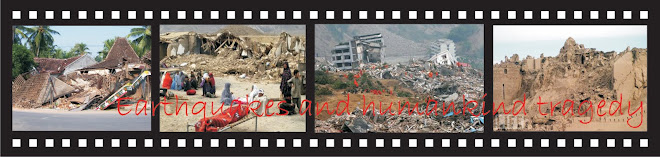
WHY JAVANESE HOUSES WERE SEVERE COLLAPSED IN THE 2006 EARTHQUAKE ?
In general the factors causing the failure of Javanese house can be affected by: the epicenter proximity, the geological formation, high density level, and weak construction of the houses (Idham, N, et.al 2010a)
The epicenter was relatively very close and shallow to the object of Javanese houses
According to USGS, the magnitude was 6.2 Ritcher scale and the epicenter was at 7.96°S, 110.46°E with 10 km depth. The epicenter was located in the Opak river estuary around 20 km from Yogyakarta with shallow depth. It means that the source of the quake was on the site of the houses (Bantul district of Yogyakarta). The magnitude would have less meaning if the proximity to the epicenter is also less by means far away from the energy resource. Some other earthquakes actually stroke later such as the 7.0 SR West Java Province on September 2, 2009 with the epicenter distance 195 km from Jakarta and 46.2 km depth under the sea (USGS 2009a). In this case, it was causing casualties ‘only’ 57 fatalities and 300 injured from about 10000 damaged houses. This earthquake was also felt from Yogyakarta and Central Java but it has no effect or little, if any, to the buildings there. The other earthquake happened in November 13th with 5.4 SR magnitude 360 km away from Jakarta and 41 km depth (USGS 2009b). The last quake has no any casualties and building damage. In this matter, the MMI scale is more useful in measuring the effect earthquake to the buildings since it based on the impact in the area. If the 2006 Java earthquake has VIII-IX, while the September 2, 2009 west Java earthquake only VI-VII.
Geological formation of the sites bolstered up the effect to the buildings
Instead of spreading to the surrounding site in radial way, the 2006 Java earthquake had different effect in some areas related to the local geological condition. Soft soil easily amplifies shear waves transfer from epicenter. MAE recorded that horizontal peak ground accelerations in the region of 0.20~0.34g and vertical ground motion is estimated from structural collapse back-analysis at 0.18~0.30g which was categorized very high (Elnashai AS, et.al, 2007). As a result, buildings located near river line or wet land will be affected more. From the 2006 earthquake data, the nearer area of the epicenter, Gunung Kidul has less effect since the ground is more rigid constituted from limestone. In other hand, farer area as Klaten Regency with most wet agricultural soil has more collapsed houses. Unfortunately, as a consequence of agricultural land, Bantul and Klaten have sit on soft soil and will have more threat from earthquake disaster compared to surrounding areas. The wet areas stretched from Bantul to Klaten are also known as Opak vault.
The affected areas have very high density of houses
Java Island in general is the densest population in the world by 979/km². Among of them, Bantul district where collapsed houses were high is the densest area in Java with population of 831,955 living in 226,777 houses in 506.85 km² area or 1641.4/km² of inhabitants and 447.4 houses in every km² (DEPKES 2007). When the 2006 earthquake stroke, 148,440 out of 218,345 houses (67.9%) in Bantul were non inhabitable or badly damaged and collapsed (BAPPENAS 2006).
The houses structure was very weak and built without earthquake consideration
Eventhough Javanese houses were originally constructed from wood, the modern development shows that brick is the most material used for structural system of the houses. According to Boen (2006), the houses collapsed from Java 2006 were mostly built by masonry either with or without reinforced concrete frame. The weak masonry was the main factor to collapse of the building while for the newer with reinforced concrete; improper connection is the most aspect of structural failures. Those structural failures were mainly because of lack in earthquake consideration since 1943 when big earthquake, for the last time, was causing high casualties before it happen again in 2006.

The load bearing brick-wall construction has been used widely as preferred house construction system together with timber frame since the Dutch occupied Java Island and started to colonize it in the early 17th century till recent times (Prijotomo,1996). For Javanese, the brick house then has been used as a symbol of social status of family of the owner (Koentjaraningrat, 1984). Unfortunately, this new concept was followed without any consideration in earthquake potential threat. The limitation of their economy and the lack awareness of proper construction of the houses were some of the main problem. As a result, this became one of factors contributing the weakness of the house construction and causing so much loss by recently quakes.
The epicenter was relatively very close and shallow to the object of Javanese houses
According to USGS, the magnitude was 6.2 Ritcher scale and the epicenter was at 7.96°S, 110.46°E with 10 km depth. The epicenter was located in the Opak river estuary around 20 km from Yogyakarta with shallow depth. It means that the source of the quake was on the site of the houses (Bantul district of Yogyakarta). The magnitude would have less meaning if the proximity to the epicenter is also less by means far away from the energy resource. Some other earthquakes actually stroke later such as the 7.0 SR West Java Province on September 2, 2009 with the epicenter distance 195 km from Jakarta and 46.2 km depth under the sea (USGS 2009a). In this case, it was causing casualties ‘only’ 57 fatalities and 300 injured from about 10000 damaged houses. This earthquake was also felt from Yogyakarta and Central Java but it has no effect or little, if any, to the buildings there. The other earthquake happened in November 13th with 5.4 SR magnitude 360 km away from Jakarta and 41 km depth (USGS 2009b). The last quake has no any casualties and building damage. In this matter, the MMI scale is more useful in measuring the effect earthquake to the buildings since it based on the impact in the area. If the 2006 Java earthquake has VIII-IX, while the September 2, 2009 west Java earthquake only VI-VII.
Geological formation of the sites bolstered up the effect to the buildings
Instead of spreading to the surrounding site in radial way, the 2006 Java earthquake had different effect in some areas related to the local geological condition. Soft soil easily amplifies shear waves transfer from epicenter. MAE recorded that horizontal peak ground accelerations in the region of 0.20~0.34g and vertical ground motion is estimated from structural collapse back-analysis at 0.18~0.30g which was categorized very high (Elnashai AS, et.al, 2007). As a result, buildings located near river line or wet land will be affected more. From the 2006 earthquake data, the nearer area of the epicenter, Gunung Kidul has less effect since the ground is more rigid constituted from limestone. In other hand, farer area as Klaten Regency with most wet agricultural soil has more collapsed houses. Unfortunately, as a consequence of agricultural land, Bantul and Klaten have sit on soft soil and will have more threat from earthquake disaster compared to surrounding areas. The wet areas stretched from Bantul to Klaten are also known as Opak vault.
The affected areas have very high density of houses
Java Island in general is the densest population in the world by 979/km². Among of them, Bantul district where collapsed houses were high is the densest area in Java with population of 831,955 living in 226,777 houses in 506.85 km² area or 1641.4/km² of inhabitants and 447.4 houses in every km² (DEPKES 2007). When the 2006 earthquake stroke, 148,440 out of 218,345 houses (67.9%) in Bantul were non inhabitable or badly damaged and collapsed (BAPPENAS 2006).
The houses structure was very weak and built without earthquake consideration
Eventhough Javanese houses were originally constructed from wood, the modern development shows that brick is the most material used for structural system of the houses. According to Boen (2006), the houses collapsed from Java 2006 were mostly built by masonry either with or without reinforced concrete frame. The weak masonry was the main factor to collapse of the building while for the newer with reinforced concrete; improper connection is the most aspect of structural failures. Those structural failures were mainly because of lack in earthquake consideration since 1943 when big earthquake, for the last time, was causing high casualties before it happen again in 2006.

Figure Javanese House's Changes in Material Structure
The load bearing brick-wall construction has been used widely as preferred house construction system together with timber frame since the Dutch occupied Java Island and started to colonize it in the early 17th century till recent times (Prijotomo,1996). For Javanese, the brick house then has been used as a symbol of social status of family of the owner (Koentjaraningrat, 1984). Unfortunately, this new concept was followed without any consideration in earthquake potential threat. The limitation of their economy and the lack awareness of proper construction of the houses were some of the main problem. As a result, this became one of factors contributing the weakness of the house construction and causing so much loss by recently quakes.
Based on Paper:
Idham, N; Mohd, M, and Numan, I (2010a) ”Why The Javanese Houses Have Failed In The 2006 Earthquake”, in proceeding of the International Conference on Sustainable Built Environment (ICSBE 2010) pp.121-128. Faculty of Civil Engineering and Planning, Islamic University of Indonesia, August 2010.
Jumat, 05 November 2010
MERAPI IS NOT FRIENDLY ANYMORE
I just did nothing and tend to be silent when heard that Mount Merapi was really getting raged. Friday November 5th 2010 early morning hours in Turkey or at 5 am Western Indonesian Time, I got message from my wife who is still at 13rd KM in Jalan Kaliurang Yogyakarta that our house could not be inhabited anymore, volcanic mud was everywhere in the yard and street, the air was filled with dust and the very smell of sulfur, visibility was almost zero. My wife and children have to, be willing or not, just to be refugee joint with others displaced down to a safer place. Unfortunately, I could only support them from afar.
This disaster is truly beyond our expectations. Mount Merapi, which used to be very friendly and part of our life, now seemed to turn into a hideous monster. Hundreds of deaths and thousands of others suffered, thousands of dead animals, thousands of hectares of dry crops now are easily found in our region just like deserted region. The mount itself seems as not more of a part of our lives, but turned hostile and attack us openly. We don’t know what sin we have and what mistakes we did, the nature obviously started no longer friendly to us now.
Behind this disaster, we still have to be grateful; still remain in the protection of Almighty God than those who were unfortunately cannot be saved anymore from the disaster. In a situation like this we really can see clearly who the angels are, the voluntary helper. Hundreds of volunteers, both civilian and military were risking their own life to help the victims whether alive or dead who was blasted by hot clouds trim of Merapi. Yes ... it should be, we should helping each other, regardless any command and request from the authority. This nation large population would have to solve any kind of problem if we can help each other, holding hands with sincerity. It is time to lose our frills fanaticism to certain organization, politics and even religion for the sake of humanity that might have been estranged from our conscience. Not doing so, it seems could not to be denied that the nature starts to be unfriendly to us.
Senin, 01 November 2010
Is the CONCRETE FRAME HOUSE MOST SECURE for EARTHQUAKE RESISTANT HOUSE (2)
In the midst of my routine busyness (and bored to!) to wrote my PhD thesis, I tried again to fill this blog just in order not to neglect and fills my saturated time since being away from my wife and kids this (... ehem). My topic now is not far away from the theme of my thesis, traditional Javanese house and its relation to earthquakes.
STIFFNESS, STRENGTH, and DUCTILITY
As a result of the earthquake in Bantul 2006, many buildings whether it is called traditional or modern building, mostly badly hit by the devastated earthquake. Soon after, the government and hundreds of donors rebuilt shelters in the Bantul and surrounding areas with new houses through a reconstruction program. The popular reconstruction house types were built from bricks wall altogether with reinforced concrete frame. Those new houses are considered the safest or most appropriate to anticipate the future earthquake. Previous homes, especially the traditional houses, are considered less suitable for earthquake resistant buildings. So the people in Bantul and surrounding communities then build their homes with this type of reinforced concrete which was previously not widely used, especially by rural communities who had still familiar with the house bricks or wooden house using 'gedhek' or 'gebyok'. Now it can be ascertained when you come to the Bantul, old style house ‘tempo doeloe’ such as Javanese Limasan, is rarely used anymore in Bantul, and just as a memory.
Just to note, that houses by framework of concrete bricks indeed be one solution to the earthquake-safe building houses but not the safest one. The nature of the framework of concrete brick wall relies on the principle of stiffness and strength rather than ductile. The principles of earthquake resistant buildings are supposed to cover all three issues. Stiffness is the principle of building to resilience the shocks so that the building does not change in shape, while building strength is the principle of maximum load of an earthquake can be accommodated, so it is always associated with load resistance. Ductile in the other hand more to do with building endurance to change its shape (flexible, plastic), or absorb the force, according to the existing burden. The principle stiffness in buildings is by applying heavy materials such as bricks and concrete that is rigid or rigid and not flexible. While ductile is more suitable when using a material like wood and steel.
Unfortunately, the principle of prioritizing the stiffness first in building only fit for the area that have small earthquake risk since consideration to resist shocks will be relatively low. This is worst by the burden of building by using materials such as bricks and concrete slabs. High load in addition to relatively low plasticity are also vulnerable to the dangers of rolling for lateral or horizontal forces caused by the earthquake. It's also very dangerous if used as a residential building since it element will ruins the occupants under yet of lightweight materials such as wood. Furthermore, if the quality of implementation is also low, the risk of earthquake will be very-very high.
This is what bothered over my mind. New houses in Bantul were completely been built using bricks and concrete slabs. Regardless of whether its implementation is right or not, the use of this material type is still worrying for earthquake prone areas such as in Bantul. The houses with a high ductile principle should be more secure and less stressed rather than the reinforced concrete which is more rigid and brittle. Although some opinions said it would be very expensive for using wood, but the reinforced concrete building materials are also not that expensive now? And probably should not be forgotten, the potential use of local wood or bamboo or palm-coconut wood also still can be improved. And another thing, by building houses made of wood we will also return to preserve the Javanese traditional house which previously been widely used (in the future we will discuss why many traditional houses collapsed in the quake of 2006 in Java).
WHAT HAPPEN if THESE VOLCANO MOUNTAINS are STARTING to ACTIVE?
As a country located in an active seismic area "ring of fire", it is normal to have seismic activities such as earthquakes and activated volcanoes through the daily life of Indonesian. Both circum Eurasian tectonic in southern Indonesian islands (exactly west and south Sumatra Island Java Island) and Pacific Ridge in the Northeast is known as the most active tectonic lines in the world. Some literatures stated that earthquakes and volcanic activity is closely related to each other. This is clearly evident in 2006 when activity volcanoes including mount Merapi as it writhed along with the earthquake in Yogyakarta, Java, May 27, 2006 or July 17, 2006 on the southern coast of Pangandaran which was resulting tsunami. Even when the earthquake occurred on May 27, 2007 Yogyakarta, many residents thought that the vibration was came from Merapi, since the mountain had to ‘cough’ several times previously in the north of Yogyakarta. Instead, earthquake was precisely 'attack' from the south of Yogya that claimed many casualties and great losses at the time.
My concern now is that the natural condition is almost similar to the 2006. As I type this article, according to BMG reports; there are about 21 mountain activities of about 300 volcanoes in Indonesia.
From the 21 volcanoes, 2 of them have 'siaga' or secondary warning, which are Gunung Ibu in Northern Maluku and Gunung Karangetang, Northern Sulawesi.
19 Volcanoes which have 'waspada' or first warning from their activity:
1. Gunung Seulawah (Aceh)
2. Gunung Sinabung (Karo, Sumut)
3. Gunung Talang (Solok, Sumbar)
4. Gunung Kaba (Bengkulu)
5. Gunung Kerinci (Jambi)
6. Gunung Anak Krakatau (Lampung)
7. Gunung Papandayan (Garut, Jabar)
8. Gunung Slamet (Jateng)
9. Gunung Bromo (Jatim)
10. Gunung Semeru (Lumajang, Jatim)
11. Gunung Batur (Bali)
12. Gunung Rinjani (Lombok, NTB)
13. Gunung Sangeang Api (Bima, NTB)
14. Gunung Rokatenda (Flores, NTT)
15. Gunung Egon (Sikka, NTT)
16. Gunung Soputan (Minahasa Selatan, Sulut)
17. Gunung Lokon (Tomohon, Sulut)
18. Gunung Gamalama (Ternate, Maluku Utara)
19. Gunung Dukono (Halmahera Utara, Maluku Utara)
While a large earthquake has occurred with 7.2 M the Mentawai Islands accompanied by tsunami is one of the effects of the rise of the Eurasian tectonic activity and they are closely related to one another. Mount Talang in West Sumatra, in this case most associated with the Mentawai quake, one thing is that almost similar to the Merapi and the 2006 earthquake in Bantul Yogyakarta. According to the record, the year of1981 was a quake occurred in Yogyakarta when Mount Merapi was also being active with peak of eruption occurred on June 15, 1984.

Although it already denied by Indonesian Geological board, and still needs to be proven by some more data, we deserve to be careful and vigilant in this matter. I do not intend to worst the recent Merapi situation with another disaster by this article. However, we don’t know if the things we thought might be happen. Hopefully the Saturday, October 30 eruption of Merapi early days ago was the last time and not will be followed by earthquake that can cause disasters. Let us keep praying and trying so the disaster far away and does not always come in this country.
UPDATE!
November 9th, 2010
After the Merapi’s massive eruption in the early morning on Friday 5th November 2010, today it had followed by a middle magnitude 5.6 M earthquake in southern of Bantul after 4 M stroke southern area of Wonosari lastweek. Based on information received from BMKG Yogyakarta, the quake occurred at 8.98 south latitude (LS) and 110.08 east longitude (BT) at 125 km southwest of Bantul regency, Yogyakarta at a depth of 10 km located in the sea.
Though it was not powerful in Yogyakarta, but could be felt in some regions in Central and West Java. The most important is that this quake did not as destructive earthquake. That's what I worry about the quake. By this already occurrence,an earthquake in the south of Merapi Volcano, I hope it will not followed by other. Amen
My concern now is that the natural condition is almost similar to the 2006. As I type this article, according to BMG reports; there are about 21 mountain activities of about 300 volcanoes in Indonesia.
From the 21 volcanoes, 2 of them have 'siaga' or secondary warning, which are Gunung Ibu in Northern Maluku and Gunung Karangetang, Northern Sulawesi.
19 Volcanoes which have 'waspada' or first warning from their activity:
1. Gunung Seulawah (Aceh)
2. Gunung Sinabung (Karo, Sumut)
3. Gunung Talang (Solok, Sumbar)
4. Gunung Kaba (Bengkulu)
5. Gunung Kerinci (Jambi)
6. Gunung Anak Krakatau (Lampung)
7. Gunung Papandayan (Garut, Jabar)
8. Gunung Slamet (Jateng)
9. Gunung Bromo (Jatim)
10. Gunung Semeru (Lumajang, Jatim)
11. Gunung Batur (Bali)
12. Gunung Rinjani (Lombok, NTB)
13. Gunung Sangeang Api (Bima, NTB)
14. Gunung Rokatenda (Flores, NTT)
15. Gunung Egon (Sikka, NTT)
16. Gunung Soputan (Minahasa Selatan, Sulut)
17. Gunung Lokon (Tomohon, Sulut)
18. Gunung Gamalama (Ternate, Maluku Utara)
19. Gunung Dukono (Halmahera Utara, Maluku Utara)
While a large earthquake has occurred with 7.2 M the Mentawai Islands accompanied by tsunami is one of the effects of the rise of the Eurasian tectonic activity and they are closely related to one another. Mount Talang in West Sumatra, in this case most associated with the Mentawai quake, one thing is that almost similar to the Merapi and the 2006 earthquake in Bantul Yogyakarta. According to the record, the year of1981 was a quake occurred in Yogyakarta when Mount Merapi was also being active with peak of eruption occurred on June 15, 1984.

Figure. Relation between earthquake (as result of plates subduction) and volcanoes
Although it already denied by Indonesian Geological board, and still needs to be proven by some more data, we deserve to be careful and vigilant in this matter. I do not intend to worst the recent Merapi situation with another disaster by this article. However, we don’t know if the things we thought might be happen. Hopefully the Saturday, October 30 eruption of Merapi early days ago was the last time and not will be followed by earthquake that can cause disasters. Let us keep praying and trying so the disaster far away and does not always come in this country.
UPDATE!
November 9th, 2010
After the Merapi’s massive eruption in the early morning on Friday 5th November 2010, today it had followed by a middle magnitude 5.6 M earthquake in southern of Bantul after 4 M stroke southern area of Wonosari lastweek. Based on information received from BMKG Yogyakarta, the quake occurred at 8.98 south latitude (LS) and 110.08 east longitude (BT) at 125 km southwest of Bantul regency, Yogyakarta at a depth of 10 km located in the sea.
Though it was not powerful in Yogyakarta, but could be felt in some regions in Central and West Java. The most important is that this quake did not as destructive earthquake. That's what I worry about the quake. By this already occurrence,an earthquake in the south of Merapi Volcano, I hope it will not followed by other. Amen
Langganan:
Postingan (Atom)